So I learned this past weekend that this region of Northwestern Ontario is called Sunset Country and I just love that so much. The sunsets here are truly stunning every single night so it makes so much sense.
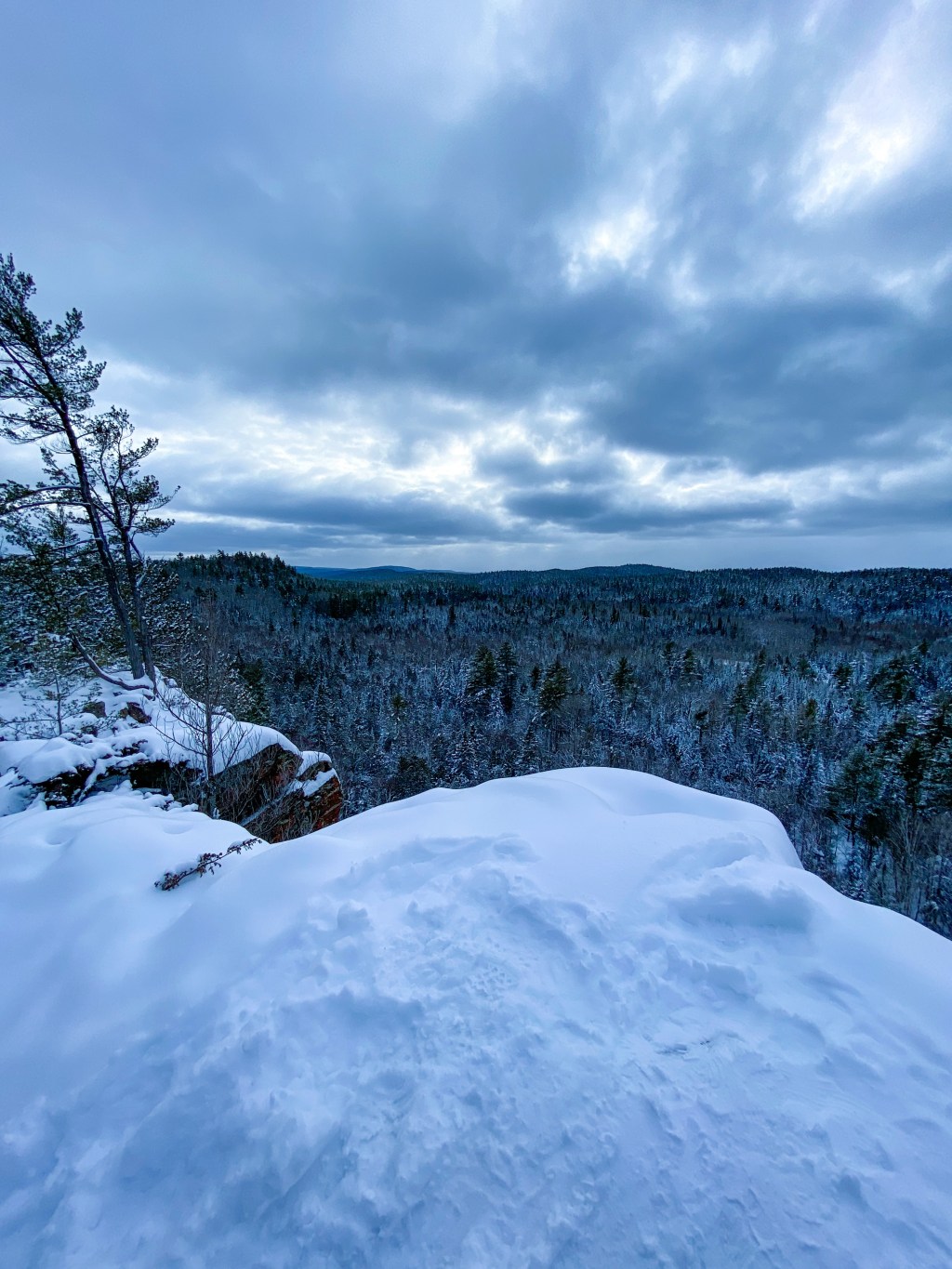
Note: the blog post’s featured image is actually from the Eagle’s Nest Trail in Calabogie, Ontario.
I wanted to do one of these hikes yesterday, the Sioux Mountain Trail, but I went in completely the wrong direction and then noticed how much my shoes were rubbing and came home. I now have a massive blister on my left heel that I am dying (but resisting the urge) to pop. So I definitely need some gear before I get into this properly.
In terms of gear, some locals have said that there are certain trails that I will need bear spray, so that’s definitely a priority. I also texted my friend who moved to Calgary last year and has done some serious hikes out there yesterday after I noticed how huge my blister is and asked for her recommendations for gear. She recommended a Camel Back backpack, Keen boots, gaitors, crampons, merino wool base layers, fleece lined pants, and a puffer jacket. She moved in the late summer/fall so most of her hiking has been fall/winter hiking. So obviously would really only need the bear spray, bug spray (the black flies are supposedly horrendous up here), boots, and a backpack for now.
The other thing is that I am really having a hard time finding information online about trails and hikes nearby. The AllTrails app has the closest trail at over an hour and a half away and there is no way that is correct.
Sioux Mountain Trail: The legend behind the town of Sioux Lookout is that the Ojibway people were defending their territory against invading Sioux people. They came to this high point and used it to lookout for the invading Sioux warriors. They were able to spot the Sioux canoes coming and were able to go on the offensive and defend their territory. That’s a really poor telling of the story, here’s a link to a better version: . But now there is supposedly a trail there where you can hike up and see all around the whole area. I am having a really hard time figuring out where the trail head is. On GoogleMaps it has me parking on one side of Pelican Lake and then magically getting across the lake? I don’t see a bridge or anything and I have no clue if it is public land or private land, if I can walk around the lake, how long it is, nothing.

Ojibway Provincial Park. There are 6 different trails in the park, it doesn’t open until May 21st this year so this will be more of a summer one. I really like that there are some super short trails and then a longer one, 6km. So you can get in and out really quickly if you want but still get some nature time and then if you have more time you can do the longer ones.
The trails are: Boreal Walking Trail (1.5 km, easy), Lakeshore Trail (6km, moderate), Little Walking Trail (0.8km, easy), Red Pine Walking Trail (0.5km, easy), Ridge Bottom Trail (2.8km, moderate), and Terry Lake Trail (1.5km, easy) and apparently you can frequently see moose on this one and I really want to see a moose. From a very safe distance, and not in my car on the road, I am honestly terrified of moose. In terms of my Canadian fears it is 100% #1 Canada Geese, #2 Moose, #3 Ketchup (they put it on everything I think it is disgusting).
The park also has canoe rental and a beach, which could be nice combined with one of the short hikes for a nice little outdoorsy day.
Cedar Bay Trails: There are several trails here and there is actually information about this network which is exciting as someone new to the area. There is also a stable here that is closed to the public during the pandemic but does have horse leasing that I’m going to look into, it has been ages since I rode and I miss it. I was actually really close to the trailhead for the Interpretive Trail yesterday when I was looking for Sioux Mountain. I turned back at the cemetery when I realized I had no clue where I was, where I was going, or what was around me.

Further away are Dryden and Vermillion Bay. The Dryden website actually has a great list that I’m going to work through. Vermillion Bay is where the AllTrails App had trails listed. In Dryden there are places like Aaron Provinical Park, Laura Howe Marsh, and some “urban” trails. Vermillion Bay has a full day trail called Goblin Lake Trail (11km, moderate) and the shorter Boulder Ridge Trail (1km, easy), Rock Point Trail (4km, moderate), and Spruce Fen Boardwalk (1km, easy, barrier-free, which is very cool). It seems like some of these trails may link into Blue Lake Provincial Park which doesn’t open until May 21 this year.

Closer to Kenora (about 3 hours west) you can get into the Sioux Narrows/Nestor Falls area and their trails. Kenora is also a bit more “urban touristy” and less “fisherman touristy” than Sioux Lookout and seems to have a bit more detail and internet accessible information about their trails. I’ve had Kenora described to me in a very SAT way: Kenora is to Winnipeg as Muskoka is to Toronto. Which basically means it’s the rich people’s cottage country. At the moment we aren’t allowed to go to Kenora (or Thunder Bay) without quarantining for 2 weeks, so I’m not heading that far at the moment, but I’m really hoping that by this summer I’ll be able to get over there for a long weekend.
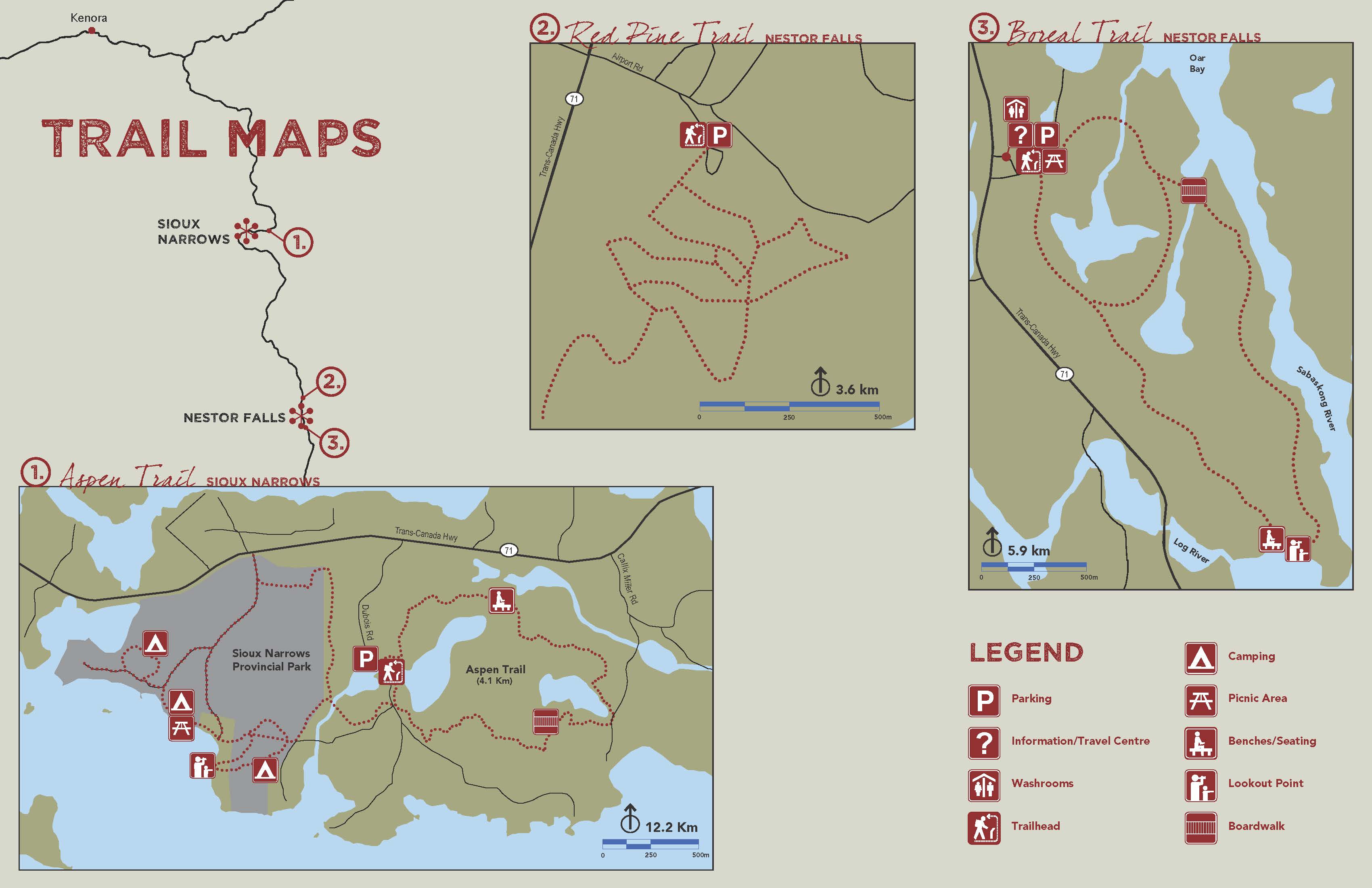
Kenora seems to have more marked trails and has a lot on AllTrails, which will make life easier this summer. The Boyne Lake Trail and Tunnel Island Trails look ideal.
It’s very interesting to look into trails up here, just in general there seems to be less open-source information on the trails, which I wouldn’t have expected. I always found in Southern Ontario that all I had to do was google hike near me and a lot more information would come up. Where to park, where the trail head was, was there a water refill station at the trail head, how far from parking to the trail head, just generally a lot more information. This is kind of funny to say because I literally told my sister in January that I didn’t think the internet needed another hiking blog but umm here we are and I actually do think there is a hole here. I’m not going to start recommending gear or anything, but just actually providing information on these trails to new residents and other non-locals seems to be a gap in the available information.
If you have any hike recommendations for the Sioux Lookout/Dryden area I would love to hear them!
Laura


